One survey across the waterline
Jetties, wharves, boat ramps, sea walls and harbour channels sit across the waterline, so they are usually surveyed twice, once from the water and once from land, and then stitched together. Gaps at the waterline and under structures are common.
MĀKI surveys both in one campaign. A compact uncrewed survey boat (USV) with multibeam or single-beam sonar maps the seabed, including beneath jetties where crewed boats cannot go. An RTK drone maps the structure and shoreline, and the two are merged into one georeferenced 3D model.
Where you need to see the condition of a submerged structure, our underwater ROV adds close-up HD video, with no dive team in the water.
What we deliver
- Bathymetric surface and contours of the seabed, berth or channel
- Topographic model and orthophoto of the structure and shoreline
- Merged topo-bathymetric 3D model, with no gap at the waterline
- Cross-sections through channels, berths and structures
- Underwater HD video of submerged structures by ROV, where required
- GIS and CAD-ready data with a summary report
Under the structure
Our USV is piloted between and beneath piles to map the seabed under jetties and wharves, where crewed survey boats struggle to reach.
Across the waterline
Sonar below and drone photogrammetry above are tied to the same coordinate system, so engineers get one continuous model of the structure and its foundations.
No barge or dive team
Everything launches from the shore. Sonar and the ROV replace divers for most underwater work, keeping people out of the water.
Centimetre-level positioning
RTK GNSS on the boat and the drone gives survey-grade positions for design, repair and consent work.
Fast mobilisation
Portable platforms and an in-house team mean we can mobilise quickly for tight programmes and tide windows.
Repeat monitoring
A baseline survey followed by repeats shows scour, sediment movement and coastal change over time.
Structures and sites we survey
- Jetties and wharves: seabed beneath and around the structure, piles and approaches
- Boat ramps and pontoons: ramp toe, scour and approach depths
- Sea walls, revetments and rock walls: the wall face above water and its toe below
- Harbour and estuary channels: channel depth and shape for navigation and maintenance planning
- Marina basins and berths: depths and sediment build-up
- Outlets and structures in tidal water: scour and condition around stormwater outlets and culverts
Common reasons for a coastal survey
- Checking channel and berth depths for navigation and maintenance dredging
- Looking for scour around piles, walls and outlets
- Engineering assessment before repair, renewal or replacement
- Flood resilience and coastal change monitoring
- Design and consent baselines for new coastal works
How a MĀKI coastal survey works
1. Planning. We agree the outputs you need, confirm the coordinate system and datum, check access and plan the work around tide windows.
2. On-site survey. The USV runs sonar lines across the site and under structures, while the RTK drone captures the structure and shoreline, ideally at low water.
3. Processing. Sonar data is cleaned and gridded, drone imagery is processed into a point cloud and orthophoto, and the two are merged into one 3D model.
4. Delivery. You receive the merged model, surfaces, cross-sections, data files and a summary report. We confirm turnaround with your quote, based on the size of the site.
Proven on real projects
A selection of recent work using this service for New Zealand councils and contractors.
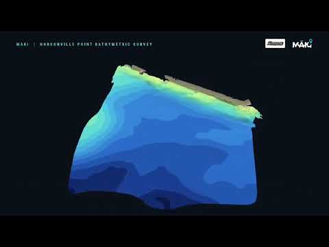
Auckland Council · with Glasgow Contractors
Seabed mapped beneath a jetty
A multibeam USV under the jetty and an RTK drone above, combined into one 3D model.
Read the case study →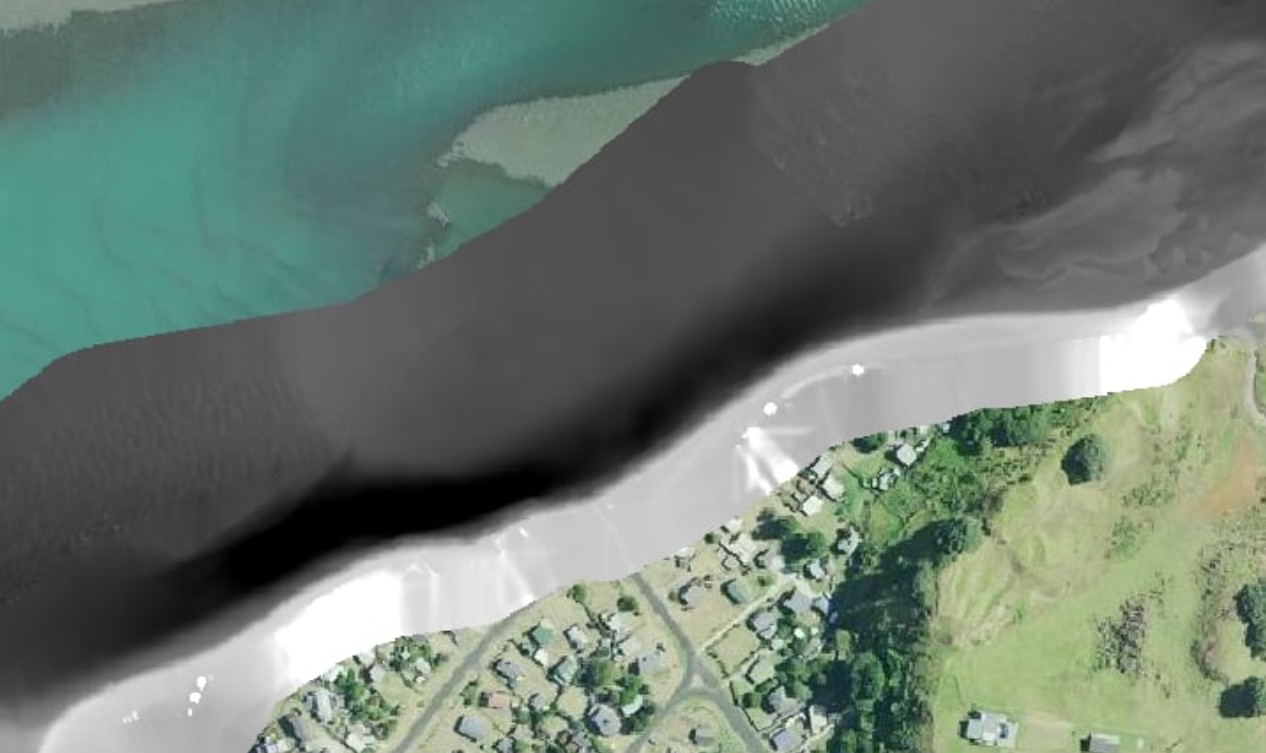
Ōtorohanga District Council
Harbour channel and stone wall in 3D
USV bathymetry and drone photogrammetry merged into one dataset across the waterline.
Read the case study →Frequently asked questions
Can you survey underneath a jetty or wharf?
Yes. Our compact uncrewed survey boat (USV) is piloted between and beneath the piles with multibeam sonar, mapping the seabed in places a crewed survey boat cannot safely reach. At Hobsonville Point in Auckland we mapped the seabed beneath a jetty this way.
What is a topo-bathymetric survey?
A survey that maps both the land and structures above the water (topography) and the bed below it (bathymetry), then joins them into one georeferenced dataset with no gap at the waterline.
Do you need divers to inspect submerged structures?
Usually not. Sonar maps the shape of the seabed and structure, and where close-up visual condition is needed our underwater ROV records HD video while the team stays out of the water.
How accurate are the surveys?
Sonar soundings and drone imagery are positioned with RTK GNSS to centimetre-level accuracy, and both datasets are tied to the same coordinate system so they line up across the waterline.
Can the survey be planned around the tide?
Yes. We plan each campaign around tide windows, so the drone captures as much of the intertidal zone as possible at low water and the boat covers the shallows when there is enough depth.
Where does MĀKI work?
MĀKI is based in the Waikato and works across New Zealand, including for regional and district councils and contractors. Recent coastal work includes Auckland (Hobsonville Point) and Aotea Harbour.
Related resources
Underwater 3D Mapping and Jetty Survey at Hobsonville Point: the project article, with video.
Topo-Bathymetric Mapping at Aotea Harbour: joining drone and sonar data at a harbour stone wall.
Bathymetry and Topography: our depth-mapping and drone survey services.
Need a jetty, wharf or harbour surveyed?
Tell us about your site and what you need to know. We will suggest the right approach and send a quote.
Get a quote View all services