
Bathymetry & Topography
At Hobsonville Point in Auckland, MĀKI partnered with Glasgow Contractors to complete a detailed bathymetric and topographic survey within a tight timeframe. The work was carried out on behalf of Auckland Council's Healthy Waters and Flood Resilience department.
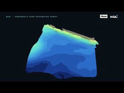
Using MĀKI's in-house designed and built uncrewed surface vessel (USV) fitted with multibeam sonar, alongside RTK drone photogrammetry, the team captured detailed above-water and underwater survey data and combined it into an integrated 3D model of the site.
The survey area extended underneath a jetty — a confined space that conventional crewed survey boats struggle to access. The project also had a tight timeframe, so the team needed to mobilise quickly and capture complete data in one campaign.
Multibeam sonar bathymetry. MĀKI's purpose-built USV mapped the underwater terrain in detail with multibeam sonar.
Under-jetty surveying. MĀKI's USV pilot navigated the vessel beneath the jetty, collecting survey data in confined spaces that would be challenging for conventional crewed vessels.
RTK drone photogrammetry. An RTK-positioned drone captured the exposed coastal structures and the surrounding topography.
Integrated 3D modelling. The above-water and underwater datasets were combined into one model, giving a more complete picture of the infrastructure and its surrounding environment.
Thanks to Glasgow Contractors for their professionalism, collaboration and trust in MĀKI, and to Auckland Council's Healthy Waters and Flood Resilience department, on whose behalf this work was carried out.
MĀKI's compact USVs reach confined and hard-to-access water, and we combine the data with drone mapping above the waterline.
Get a quote