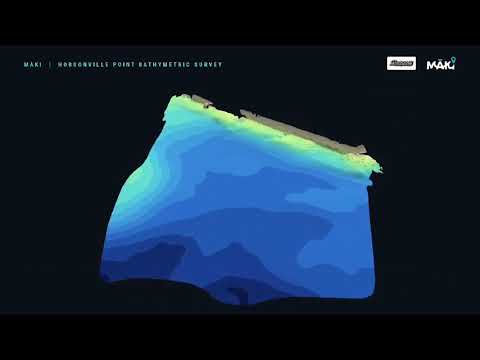
How do you survey underneath a jetty where conventional boats struggle to access?
At Hobsonville Point in Auckland, MĀKI partnered with Glasgow Contractors to complete a detailed bathymetric and topographic survey within a tight timeframe. The work was carried out on behalf of Auckland Council's Healthy Waters and Flood Resilience department.
Using our in-house designed and built uncrewed surface vessel (USV) equipped with multibeam sonar, alongside RTK drone photogrammetry, we captured detailed above-water and underwater survey data to create an integrated 3D model of the site.
Project highlights
- Multibeam sonar bathymetry — detailed mapping of the underwater terrain using MĀKI's purpose-built USV
- Under-jetty surveying — our USV pilot navigated beneath the jetty, collecting survey data in confined spaces that would be challenging for conventional crewed vessels
- RTK drone photogrammetry — capturing the exposed coastal structures and surrounding topography
- Integrated 3D modelling — combining above-water and underwater survey information for a more complete picture of the infrastructure and surrounding environment
- Rapid project delivery — MĀKI mobilised quickly to meet the project's tight timeframe
Project collaboration
Special thanks to Glasgow Contractors for their professionalism, collaboration and trust in MĀKI. We also acknowledge Auckland Council's Healthy Waters and Flood Resilience department, on whose behalf this work was conducted.
Built by MĀKI. Operated by MĀKI.
MĀKI designs and builds its USVs in-house and operates them for multibeam and single-beam bathymetric surveys, RTK drone photogrammetry and 3D mapping, water quality monitoring and sampling, underwater ROV inspections, and stormwater and water infrastructure assessments. If you have a structure or waterway that is hard to reach, get in touch.