Bathymetric Mapping
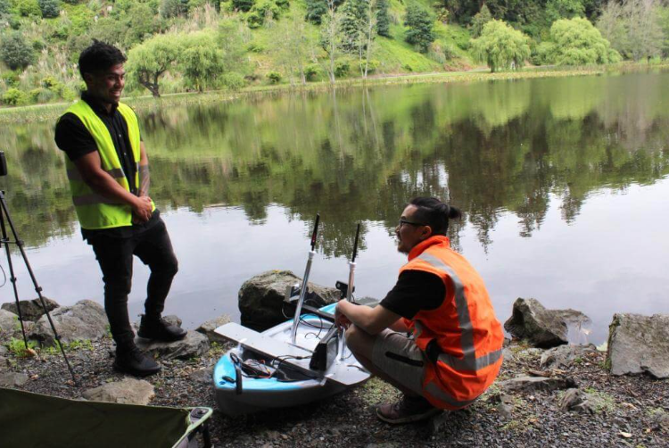
MĀKI is contracted by Waikato Regional Council to conduct a systematic bathymetric mapping programme across lakes in the Waikato region. Using in-house autonomous surface vessels equipped with single and multi-beam sonar, the programme delivers reliable, high-resolution depth data to support lake management, ecological monitoring and restoration planning across one of New Zealand's most ecologically significant regions.
Regional councils are responsible for monitoring and managing the health of freshwater bodies across their rohe. Accurate bathymetric data is foundational to this work — informing decisions on sediment loading, water volume calculations, habitat assessment and restoration interventions. However, traditional manned survey vessels are expensive, logistically complex, and in many cases restricted or impractical on smaller or ecologically sensitive lakes.
Waikato Regional Council needed a scalable, cost-effective approach to systematically survey multiple lakes to a consistent standard within a single programme.
MĀKI deployed compact autonomous surface vessels programmed to follow precise survey transect lines across each lake. The vessels operate independently once launched, collecting continuous depth readings georeferenced with RTK GPS for sub-metre positional accuracy. The autonomous approach allowed surveys to be completed with minimal on-site staffing and without disturbing the lake environment.
Data was post-processed into depth grids and 3D bathymetric models, delivered in GIS-compatible formats aligned with the council's existing data infrastructure.
The programme provides Waikato Regional Council with a consistent, repeatable baseline of lake bathymetry that can be revisited over time to detect changes in sediment accumulation, lake volume and underwater habitat — supporting long-term freshwater management objectives.
Talk to the MĀKI team about your survey requirements.
Get in touch